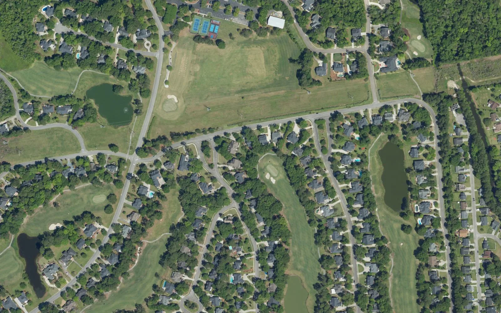
Coosaw Creek is a golf course community in the Dorchester County part of North Charleston, ZIP code 29420, zoned for Fort Dorchester High.
Last checked Oct. 12, 2026. Sources: the City of North Charleston’s PRIME North Charleston comprehensive plan, neighborhood presidents list and parks list, Dorchester County’s school attendance zone lookup, the South Carolina school report cards, the U.S. Census Bureau, CARTA, OpenStreetMap and Zillow Research.
Coosaw Creek is a neighborhood built around a golf course in the Dorchester County part of North Charleston, east of Wescott. The land use chapter of the city’s comprehensive plan (PDF) names Coosaw Creek, with Kings Grant, Indigo Fields and Whitehall, among “the older residential developments” in a planning area that “is largely within Dorchester County and is almost entirely developed as suburban residential.”
What this means for you
- Zoned high school: Fort Dorchester High, Dorchester School District Two, rated Excellent on the 2025 state report card, for every point we checked inside the city. Check an address with the county’s attendance zone lookup.
- Home value: $336,099 in ZIP code 29420 in August 2026, according to the Zillow Home Value Index.
- Nearest interstate exit: I-26 Exit 209, Ashley Phosphate Road and U.S. 52, about 5.4 miles by road.
Part of our North Charleston neighborhoods guide.
Where it is
OpenStreetMap maps the Coosaw Creek neighborhood and the Coosaw Creek Country Club golf course north of Dorchester Road, with the creek of the same name to the west. We used a half-mile circle around the neighborhood. Of the 121 points we checked, 93% were inside North Charleston’s city limits on the Census Bureau’s current boundary, and all were in Dorchester County. Inside the city, 90% were in ZIP code 29420 and 10% in 29485.
Dorchester County bills its own property tax, at a different rate from Charleston County. Look a parcel up through Dorchester County’s website before you buy, and see our property tax guide for how South Carolina’s 4% legal residence rate works.
Schools
Coosaw Creek is served by Dorchester School District Two. We checked the 112 points inside the city against Dorchester County’s 2026 attendance zones, the same map behind the district’s lookup.
| Level | School | Share of points | 2025 state rating |
|---|---|---|---|
| Elementary | Joseph R. Pye Elementary, 9701 Patriot Blvd. | 98% | Good |
| Middle | River Oaks Middle, 8642 River Oaks Drive | 100% | Average |
| High | Fort Dorchester High, 8500 Patriot Blvd. | 100% | Excellent |
The other elementary points were zoned for Windsor Hill Arts Infused Elementary. Fort Dorchester High’s 2025 graduation rate was 94.8%. Ratings are the overall ratings on the state’s 2025 report cards. More in our schools guide.
Home values
The Zillow Home Value Index for ZIP code 29420 was $336,099 in August 2026, down 1.5% from $341,352 in August 2025. For 29485, which covers the western edge, it was $369,194. Zillow’s figure for North Charleston as a whole was $310,134. The index is a modeled typical value for the middle third of homes, not a sale price, and it is not specific to Coosaw Creek. More in our home prices guide.
Parks, pools and the library
- North Charleston Aquatic Center, 8610 Patriot Blvd., about half a mile away: a 50-meter, 10-lane pool and a therapeutic pool. Hours are in our parks and trails guide.
- Wescott Park, 9006 Dorchester Road: trails, playgrounds, ball fields and dog parks; see our Wescott page.
- Coosaw Creek Country Club: OpenStreetMap maps the golf course in the middle of the neighborhood.
- Dorchester County Library, North Charleston Branch: about half a mile away, according to OpenStreetMap.
Getting around
- Interstate 26: Exit 209, Ashley Phosphate Road and U.S. 52, about 5.4 miles; Exit 205, U.S. 78 (University Boulevard), about 6.7 miles; Exit 211, Aviation Avenue and Remount Road, about 7.3 miles. Exit numbers are as mapped on OpenStreetMap.
- Charleston International Airport: about 7.6 miles.
- City Hall, 2500 City Hall Lane: about 10.7 miles.
- Bus: no CARTA route stops inside the area. The nearest stops are on Ashley Phosphate Road at Patriot Boulevard, about a mile away, served by Route 12, Upper Dorchester and Ashley Phosphate Road, according to CARTA’s schedule data.
Distances are measured on the OpenStreetMap road network from the middle of the area; they are distances, not drive times. More in our getting around guide.
Groceries and everyday stores
From OpenStreetMap, in a straight line from the middle of the area:
- Supermarkets: Lidl, about 1.3 miles; Publix, 8409 Dorchester Road, about 1.3 miles; Food Lion, 3740 Ashley Phosphate Road, about 1.4 miles; Harris Teeter, 9500 Dorchester Road, about 1.8 miles.
- Pharmacy: the nearest OpenStreetMap lists is a Walgreens about 3.3 miles away. Stores change; check before you rely on a listing.
Homeowners associations
The city’s neighborhood presidents list includes a Coosaw Creek entry that holds an annual meeting at the Coosaw clubhouse. The list does not say whether it is a homeowners association; ask the seller or the property manager.
Frequently asked questions
What schools serve Coosaw Creek?
Coosaw Creek is in Dorchester School District Two. Nearly every point we checked was zoned for Joseph R. Pye Elementary, rated Good, and all were zoned for River Oaks Middle, rated Average, and Fort Dorchester High, rated Excellent, on the 2025 state report cards.
What is the typical home value in Coosaw Creek?
Zillow does not publish a figure for Coosaw Creek alone. The Zillow Home Value Index for ZIP code 29420 was $336,099 in August 2026, down 1.5% from a year earlier.
Is Coosaw Creek in Charleston County or Dorchester County?
Every point we checked in Coosaw Creek was in Dorchester County, inside North Charleston, so homes pay Dorchester County property tax and are served by Dorchester School District Two.
How far is the North Charleston Aquatic Center from Coosaw Creek?
The aquatic center, 8610 Patriot Blvd., is about half a mile from the middle of Coosaw Creek in a straight line, according to OpenStreetMap.
Have your say