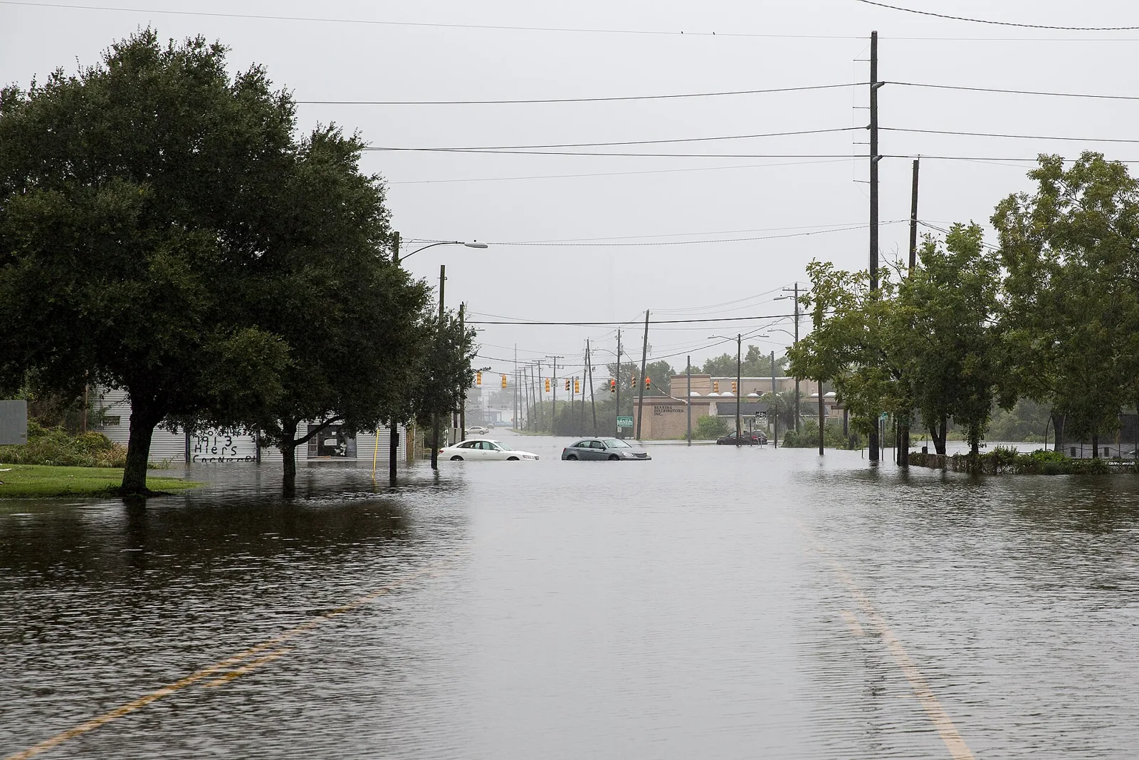
The NWS warns 1 to 2 feet of saltwater flooding is possible around the 8:18 a.m. high tide Monday, Oct. 26. Charleston Harbor is forecast to hit 8 feet, major flood stage.
The National Weather Service in Charleston has issued a coastal flood watch for Monday morning. One to two feet of saltwater flooding is possible along shorelines and tidal waterways in Charleston County.
The watch runs from 5 a.m. to 11 a.m. Monday, Oct. 26. High tide at Charleston is due about 8:18 a.m. The weather service said flooding is possible one to two hours before and after high tide. That puts the riskiest window at roughly 6:15 to 10:15 a.m. The watch was issued at 7:37 p.m. Sunday, according to the NWS alert.
“Significant saltwater inundation will render numerous roads impassable. Properties may also flood,” the weather service said.
How high the water could get
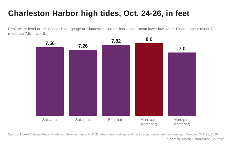
The NWS expects the tide to reach 7.9 to 8.1 feet above mean lower low water at Charleston. NOAA’s forecast for the Cooper River gauge at Charleston Harbor peaks at 8 feet about 8 a.m. Monday.
The gauge has four thresholds, set by the weather service:
| Level | Water height |
|---|---|
| Action | 6.5 feet |
| Minor flooding | 7 feet |
| Moderate flooding | 7.5 feet |
| Major flooding | 8 feet |
This is the third morning in a row of high water. The gauge peaked at 7.56 feet about 7 a.m. Saturday and 7.82 feet about 8 a.m. Sunday, NOAA’s readings show. The evening tide Saturday reached 7.26 feet. The forecast for Monday evening’s high tide, about 9 p.m., is 7 feet.
Where it floods
The weather service’s impact notes for the gauge describe what each level has meant in the past:
- At 7.5 feet, flooding reaches “locations around the Naval Complex,” the former Navy base in North Charleston, along with downtown Charleston streets including Market Street, East Bay and Rutledge.
- At 8 feet, “widespread flooding occurs in Downtown Charleston with numerous roads flooded and impassable and some impact to structures.” Docks and piers can lose access along the coast.
Downtown Charleston is about eight miles south. Commuters who drive into the peninsula Monday morning should expect closed streets there.
The weather service also has a high surf advisory in effect until 5 p.m. Monday, with breaking waves of 4 to 6 feet. A high rip current risk runs through Monday evening.
What it means for you
- Leave early or leave late. If you travel Monday morning, plan around the 8:18 a.m. high tide. The NWS said to “allow extra time as some roads may be closed.”
- Never drive into water. “Do not drive around barricades or through water of unknown depth,” the weather service said.
- Move your car. If you park on a low street near the Cooper River, the Ashley River or a tidal creek, move it to higher ground before you go to bed.
- Report a flooded city street to North Charleston Public Works at 843-745-1026. For live road conditions, dial 511 or check SC 511.
- Stay out of the ocean at Folly Beach, Isle of Palms and Sullivan’s Island through Monday evening.
Our road construction and closures page carries the latest tide forecast. Our hurricane prep guide covers evacuation zones and sandbags, and the power outages page has the numbers to call if the lights go out.
Frequently asked questions
When is the coastal flood watch in effect?
The National Weather Service in Charleston has the watch in effect from 5 a.m. to 11 a.m. Monday, Oct. 26, for Charleston and coastal Colleton counties. High tide at Charleston is about 8:18 a.m.
How high is the tide expected to get?
The NWS expects 7.9 to 8.1 feet above mean lower low water at Charleston. NOAA’s forecast for the Charleston Harbor gauge peaks at 8 feet about 8 a.m. Monday, which is the gauge’s major flood stage.
Have your say