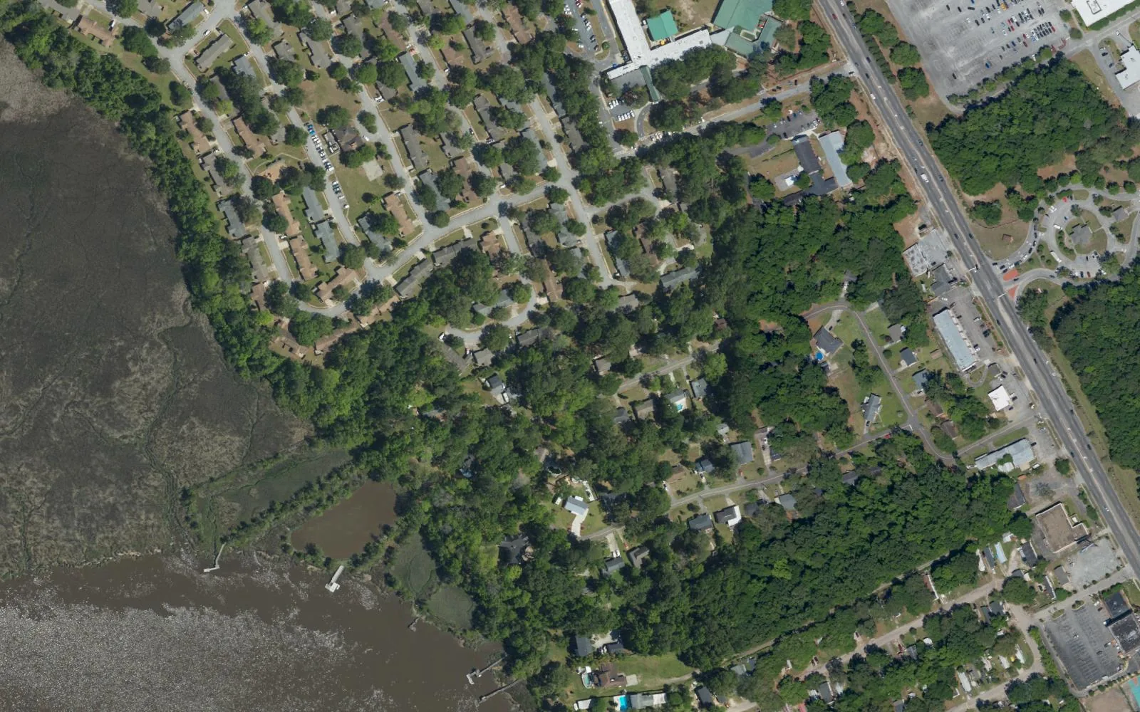
Hunley Park, Riverbend and Lambs sit off Dorchester Road by the Ashley River and Joint Base Charleston, about 3.1 miles from the airport.
Last checked Oct. 12, 2026. Sources: the City of North Charleston’s PRIME North Charleston comprehensive plan, Charleston County School District’s school lookup tool, the South Carolina school report cards, the U.S. Census Bureau, CARTA, OpenStreetMap and Zillow Research.
Hunley Park is a neighborhood on North Charleston’s west side, off Dorchester Road between Joint Base Charleston and the Ashley River. The land use chapter of the city’s comprehensive plan (PDF) puts Hunley Park and Riverbend at the northern end of a planning area made up mostly of Charleston International Airport and the Air Force base, and describes this end as “post-World War II conventional suburban large lots and streets,” with generally one way in and out of each neighborhood.
What this means for you
- Zoned high school: R.B. Stall High, rated Below Average on the 2025 state report card, for every point we checked inside the city. Check an address with the district’s school lookup tool.
- Home value: $298,473 in ZIP code 29418 in August 2026, according to the Zillow Home Value Index; Zillow publishes no figure for 29404.
- Nearest interstate exit: I-526 Exit 16, Montague Avenue and International Boulevard, about 3.8 miles by road.
Part of our North Charleston neighborhoods guide.
Where it is
OpenStreetMap places Hunley Park, Riverbend and Lambs next to one another west of Dorchester Road, with the Ashley River marsh on the west side. The city publishes no boundaries, so we used a circle of 0.4 mile around the three. Of the 69 points we checked, 93% were inside North Charleston’s city limits on the Census Bureau’s current boundary. Inside the city, 61% were in Census ZIP code area 29404, which also covers Joint Base Charleston, and 39% in 29418; all were in Charleston County.
Schools
We checked the 64 points inside the city against Charleston County School District’s attendance boundaries in its school lookup tool (elementary zones for 2026-27). Here the district splits the elementary grades between two schools.
| Level | School | Share of points | 2025 state rating |
|---|---|---|---|
| Elementary | Hunley Park Elementary, 1000 Michigan Ave. (early childhood and grades 2-5), with Lambs Elementary, 6800 Dorchester Road (grades 1-2) | 77% | Average; Average |
| Elementary | Hunley Park Elementary (early childhood), with Lambs Elementary (K-5) | 23% | Average; Average |
| Middle | Jerry Zucker Middle School of Science, 6401 Dorchester Road | 100% | Average |
| High | R.B. Stall High, 3625 Ashley Phosphate Road | 100% | Below Average |
The grade splits are as the district’s map labels them. Stall’s 2025 graduation rate was 77.8%. Ratings are the overall ratings on the state’s 2025 report cards. More in our schools guide.
Home values
The Zillow Home Value Index for ZIP code 29418 was $298,473 in August 2026, down 0.7% from $300,530 in August 2025. Zillow publishes no index for 29404. Its figure for North Charleston as a whole was $310,134. The index is a modeled typical value for the middle third of homes, not a sale price, and ZIP code 29418 covers a much larger area. More in our home prices guide.
Parks
No park on the city’s parks and facilities list falls inside the area. The nearest include Collins Park, 4155 Fellowship Road, about 2 miles away in a straight line, with a seasonal outdoor pool, ball fields, tennis and pickleball courts and a playground. More in our parks and trails guide.
Getting around
- Interstates: I-526 Exit 16, Montague Avenue and International Boulevard, about 3.8 miles; I-526 Exit 15, Dorchester Road, about 4.6 miles; I-26 Exit 213, Montague Avenue, about 4.6 miles. Exit numbers are as mapped on OpenStreetMap.
- Charleston International Airport: about 3.1 miles.
- City Hall, 2500 City Hall Lane: about 5.3 miles.
- Bus: CARTA Route 12, Upper Dorchester and Ashley Phosphate Road, stops along Dorchester Road at Lambs Road, Maryland Avenue, Lawson Drive and the Air Force base gate, and the XP3 Dorchester Road and Summerville express stops at the base gate, according to CARTA’s schedule data.
Distances are measured on the OpenStreetMap road network from the middle of the area; they are distances, not drive times. More in our getting around guide.
Groceries and everyday stores
From OpenStreetMap, in a straight line from the middle of the area:
- Supermarket: Food Lion, 7550 Dorchester Road, about 1 mile.
- Shopping center: Dorchester Crossing, about 1 mile.
- Pharmacy: OpenStreetMap lists none within 3 miles. Stores change; check before you rely on a listing.
Homeowners associations
We found no homeowners association for Hunley Park, Riverbend or Lambs in the city’s neighborhood presidents list.
Frequently asked questions
What schools serve Hunley Park in North Charleston?
Points we checked were zoned for Hunley Park Elementary and Lambs Elementary, which split the grades, then Jerry Zucker Middle and R.B. Stall High, in Charleston County School District’s attendance boundaries.
What ZIP code is Hunley Park in?
Of the points we checked inside the city, 61% were in Census ZIP code area 29404, which also covers Joint Base Charleston, and 39% in 29418. Zillow publishes no home value index for 29404; for 29418 it was $298,473 in August 2026.
How far is Hunley Park from the Charleston airport?
Charleston International Airport is about 3.1 miles by road from the middle of Hunley Park, measured on the OpenStreetMap road network.
Have your say